Tuesday, August 08, 2006

Harris Bay...


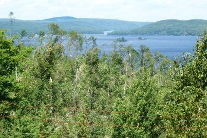
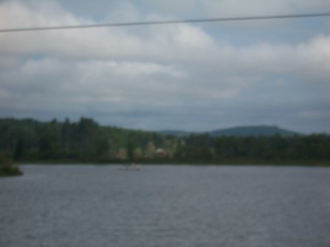
If you recognize the landmark rock in this photo, you are among the very lucky humans who have found ... Harris Bay.

How many kayaks, canoes, bass boats long for this perfect place?

For some of us it is a cove, an amazing landscape, that begins adventures.

It is the backdrop to laughter, friends, lovers, wading sheepdogs. It is Ontario summer. Maps, backpacks and beer. It arcs over decades.

When I remember a writer's line about "that high late summer sunshine, the lap of cool water on a hot rock and a perfect curve of time" ... this is the rock that always materializes in my imagination.

The rock rules over a lake at which there is always a wildly beautiful, rocky campsite ... waiting.

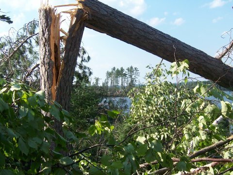
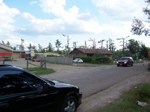
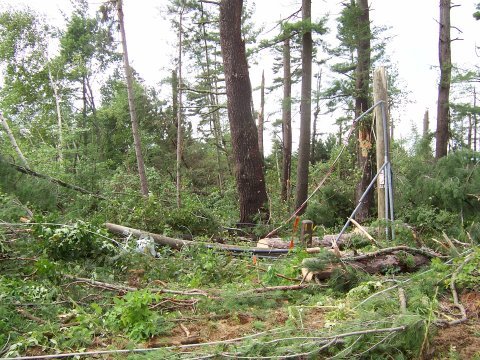
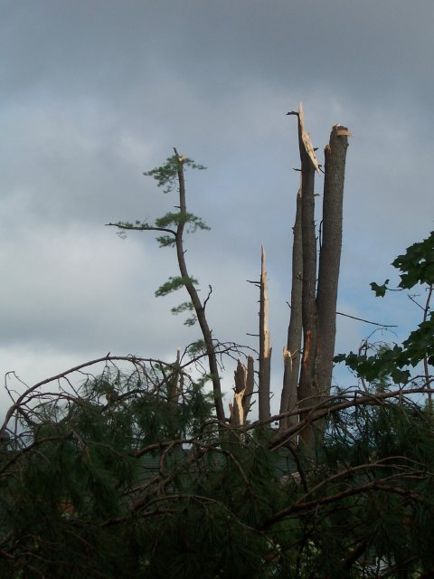
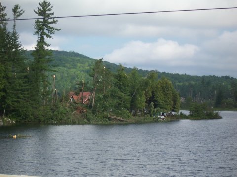
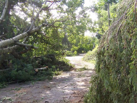
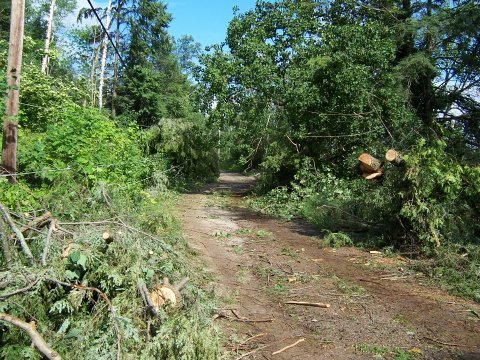
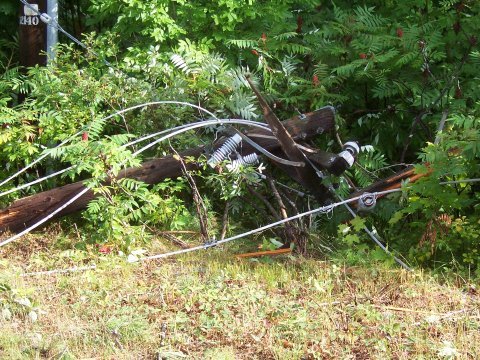
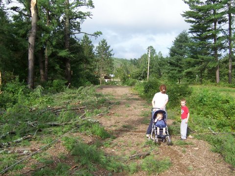
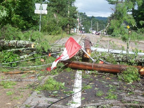
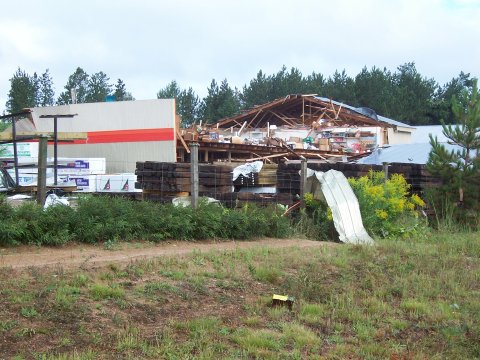
Nothing I have seen or photographed in the last five days prepared me for my visit to Harris Bay today.

I went there to photograph the landmark rock for a friend I hoped to take there. He likes rocks. It is ... or was ... a perfect place.

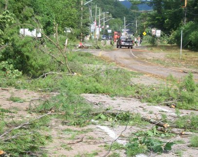
It was eaten by a tornado five days ago.

Can nature devour your past in a snap second?

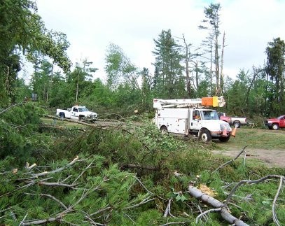
A tree fell in this forest.

Damn.

Monday, August 07, 2006

Tornado in Combermere


Opeongo Trail Resort, Combermere ON

Tornado upgraded to Level 2

Environment Canada resassesses twister in Combermere based on photographs ... winds 181 to 240 kph

Tornado upgraded to Level 2
Environment Canada reassesses twister in Combermere based on photographs

The town was savaged by a Level 2 or "strong tornado" with winds from 181 to 240 km/h, Geoff Coulson, an Environment Canada meteorologist, said yesterday.

Based on the amount of damage -- healthy white pines were snapped off and de-barked -- winds probably topped out at about 200 km/h.

The upgrade is based on the photographs taken Thursday and discussions between a tornado researcher in Toronto and an investigator on location.

The worst of the damage was through the resort area and into the town, a swath 300 to 400 metres wide and two to four kilometres long.
--Ottawa Citizen


Combermere bay near docks and marina


Combermere, intersection of Hwy 62 and Old Barrys Bay Rd


Kamaniskeg Lake


Looking north from Hwy 62


South Kamaniskeg Lk Rd


Combermere, Opeongo Trail Resort area from Hwy 62


Brook and waterfall area, South Kamaniskeg Ld Rd


Houses, S. Kamaniskeg Lk Rd near Sand Bay camp


View from scenic overlook on Hwy 62 is stripped of most large trees


Uprooted trees collapsed on cottage and car, S. Kamananiskeg Ld Rd


Hydro crews work behind Sand Bay Camp on South Kamaniskeg Lake Rd

Thursday, August 03, 2006

Combermere tornado

Combermere is about 30 miles southeast of Algonquin Park on highway 62 ... additional storm damage views of Combermere and Kamaniskeg Lake area in next 25 photos.


Combermere


Combermere


Combermere


Combermere bridge area

A summer storm....


A summer storm can be beautiful... frightening ... awesome ... powerful ... amazing ... destructive....
The road in to the cottage can be even more exciting than usual.
.. But bad things happen.

These photos were taken in Combermere, Ont, around the bridge over the Madawaska River this morning.

Obey your Dump Monkey

Some would have you believe bears prowl rural Ontario garbage dumps. Since the dumps are now gated, cottagers can no longer take their Young Ones to the nightly Bear Show, so there is no proof.

There has not been a photo of a kid sitting on a bear's shoulders since 1995.

Today, the better-tended Ontario garbage pits are under the firm and direct control of The Dump Monkey, an all-powerful figure who has seized power from the bears.

Obey your Dump Monkey.

Or feel his wrath.